


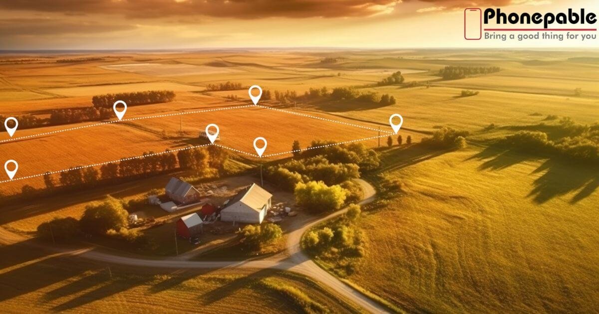
Surveying land with a smartphone brings GPS land survey power straight to your pocket. Modern phones can locate you within about 4.9 meters under open skies, enough for many field tasks (gps.gov). When using a land survey app, you can map property lines, perform site inspection, and manage asset tracking without lugging expensive gear. These smartphone-based survey tools enable offline data collection, so you can work in remote areas without internet. The app tags each coordinate and syncs when you’re back online. If you’re curious about how to survey land with smartphone, you’ll find this approach is simpler, faster, and surprisingly accurate for everyday survey needs.
Overview: Surveying Land Efficiently with Your Smartphone
Surveying land with smartphone technology lets you ditch heavy gear and use smartphone-based survey tools anywhere. You can do a boundary survey, site inspection, or property mapping with ease. This modern method helps surveyors working remotely to save time, cost, and effort across the USA.
Smartphones today support measuring geographic coordinates precisely. When paired with a land survey app, your phone tracks and tags locations, records data offline, and syncs with office systems later. This simple yet powerful setup brings GPS land survey functionality right into your pocket.
Why Choose a GPS Survey App on Mobile?
Imagine tagging points on a map directly from your smartphone. A mobile survey app ensures that every measurement and image you capture stays linked to the right spot. No more pen-and-paper mix-ups during fieldwork or utility inspection.
With offline data collection, the app works even in remote terrain. Your offline entries save automatically and synchronise collected data once you’re back in range. This makes it simple to manage surveys without wireless dependency.
Must‑Have Features in the Best Surveyor App

A top-tier land survey app should offer customisable forms to adapt to different tasks. Whether you’re doing a survey checklist or a construction snag list, you need flexibility. An ideal app includes image capture annotation, letting you attach photos to specific data points for clear documentation.
GPS tagging and accurate coordinate capture are essential. A slick UI and smooth offline mode are also keys. When the tool simplifies field service management software, it improves efficiency by linking field and office work seamlessly.
Spotlight on NestForms: GPS Land Survey App
NestForms offers a friendly and feature-rich GPS land survey solution. You build custom forms, add GPS points, and collect images—without heavy gear. It excels at collecting field measurements, offering mapping and data capture all in one mobile app.
What stands out is how NestForms supports offline data collection with no compromise. You can also export completed projects as a work completion report, or integrate with cloud systems. Its versatility makes it an excellent choice for field teams and solo surveyors alike.
How to Start Using NestForms for Land Surveys
Start by signing up on NestForms’ website and building your first form. Use drag-and-drop fields for GPS, text, and image capture annotation. Set it to record geographic position with each entry and enable offline mode for remote collection.
Install it on your Android device, or use the web builder. Deploy forms to your phone and begin surveying. The app synchronises collected data when you’re connected, sending everything back to the office automatically.
Practical Applications in Field Service Management
Survey pros in real estate use it for property mapping, boundary documentation, and site inspection photos. Construction teams log progress with construction snag list forms and punch lists. Environmental groups perform environmental habitat mapping with GPS and pictures tagged to locations.
Utility workers track assets like power poles or pipes for asset tracking. NestForms turns many tasks into smart workflows, fitting the full field service management software model in one mobile app.
Data Collection & Accuracy: Tips & Best Practices
To stay precise, always calibrate your GPS and compass before heading out. Aim for open sky for better signals, and use clear site-facing placement. Add photos at each point for visual backup, proving the data’s location.
Collect duplicate points if accuracy is critical—then check your measuring geographic coordinates later. Use NestForms to export your data and cross-check it against maps. These practices ensure your GPS land survey is rock solid.
Reporting & Documentation with NestForms
At the end of your day, export a work completion report in formats like PDF or Excel. The software supports reports for asset tracking, snag lists, and environmental studies. This helps stakeholders review results quickly.
It also keeps complete audit logs and timestamps. NestForms ensures every data point, image, and note stays traceable. That builds trust and clarity in project handovers.
Comparing NestForms to Other Survey Apps
Emlid Flow offers powerful features for professional surveyors, including linework, stakeout, and advanced GNSS support. But it requires RTK gear and subscriptions. NestForms stays lean, letting you survey with just a phone and no extra hardware.
NestForms wins when you need speed, low cost, and flexibility. For deep technical surveys, Emlid is strong. NestForms shines in field simplicity and accessibility.
Future Trends in Mobile Land Surveying
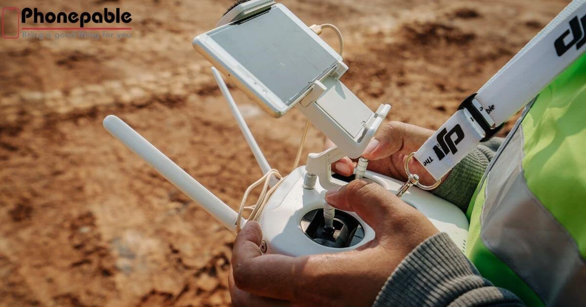
Watch for integration with drones and smartphone LiDAR for fast site inspection scans. Expect hybrid RTK modules that clip onto phones for centimeter accuracy. Mobile apps will soon support 3D mapping and real-time collaboration across teams.
Augmented reality overlays in phones could make boundary survey tasks visual and intuitive. The future points to smarter, faster, and more connected smartphone-based survey tools.
Conclusion: Choose the Right Mobile Survey Solution
Now that you know how to survey land with smartphone tools, pick your path. If you need offline data collection, customisable forms, and smooth reporting, NestForms delivers. If you want advanced GNSS workflows, consider Emlid Flow.
Start with a free trial from NestForms to experience the functionality firsthand. Then decide what fits your field needs best. You’re now equipped to transform surveys using just your smartphone.
Frequently Asked Questions(FAQs)
Can you survey with your phone?
Yes, you can perform an informal GPS land survey using your smartphone’s built‑in GPS and a survey app for basic measurements and mapping youtube.com.
What is the best land survey app?
For high accuracy on smartphones, apps like Emlid Flow paired with GNSS gear lead the market, while free tools like Mapulator offer reliable basic land survey app functionality.
How to use phone GPS to measure land?
Enable your phone’s GPS, choose a land survey app, walk perimeter points to tag coordinates, manually calibrate, and let the app calculate areas and distances .
Can GPS be used to survey land?
Yes, GPS is routinely used for land surveying, offering meter-level accuracy with smartphones, and centimeter-level precision with DGPS or RTK systems.